Indigenous Radar to Track Monsoon Winds Is Now Functional

Indigenous Radar to Track Monsoon Winds Is Now Functional

  • Research Stash
  • News
  • 1.7K

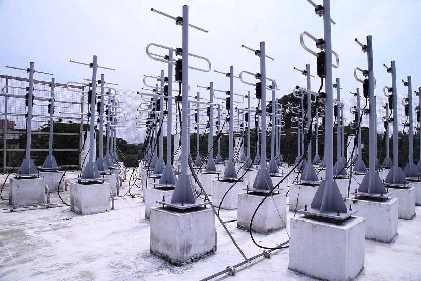
A fully indigenously built radar to scan high skies over the Indian ocean for movement of air and monsoon winds has started functioning at the Cochin University of Science and Technology in Cochin.

The radar designed and fabricated in India adds to the already available radars and Sonars to keep a close watch on the way winds move in the upper atmosphere. Situated in a strategic place where the monsoon makes the first entry into the subcontinent, the new radar will add to further the precision of weather, especially the monsoon, in India.

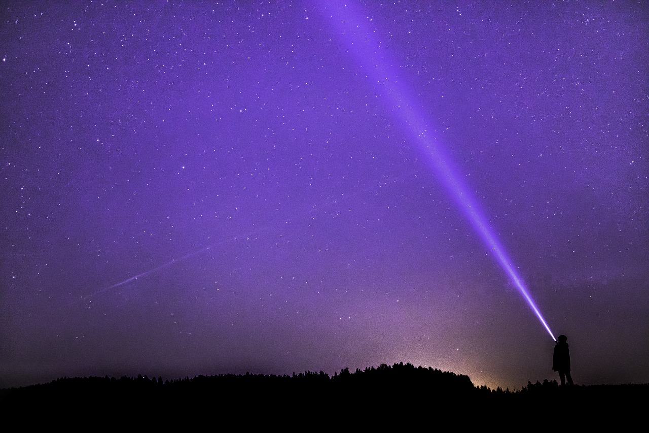
Radars are used to detect objects from a distance such as detecting a moving aircraft.  They work by sending radio waves at objects and capturing their reflections.  The waves bouncing back help detect the presence of an object.  In the case of weather, radars detect perturbations in wind and water content of the atmosphere using the same principle.  The new radar named – CUSAT Stratosphere-Troposphere Radar (CUSAT ST-205 Radar) – throws 205 MHz radio waves to detect the atmospheric perturbations.

Prof. Mohankumar

Prof. Mohankumar

The radar is specifically designed to scan the stratosphere which is the upper skies. “Troposphere is the lowest layer of the atmosphere where we live and this extends up to 17 km. In this region, temperature decreases with height. All weather systems such as clouds, rain, thunderstorms, depressions, cyclones occur in this lower part of the atmosphere. On the other hand, the stratosphere is the region above 17 km, where the atmosphere is quite calm. Weather systems are quite absent in this region.  It is always dry, and is the radiatively sensitive region,” explained Dr. K Mohan Kumar, Director, Advanced Centre for Atmospheric Radar Research, CUSAT, while speaking to India Science Wire.

During the monsoon season, strong winds known as ‘Low-Level Monsoon Jetstream’ appear around the Southern part of India. “This happens at about 1.5 km height from the ground.  Similarly around 14 km altitude, very near to the stratosphere, another strong jetstream comes from the East with a speed of 40-50 meters per second. The speed, as well as the north-south movement of these two jet streams, controls the distribution of rainfall over the Indian region. Our radar is the most suitable facility to measure the horizontal and vertical winds from an altitude of 315 m to height of 20 km with good accuracy and high resolution,” Dr. Mohan Kumar said.

The CUSAT ST-radar scans the sky horizontally and vertically in small steps of 1 degree thus getting a three-dimensional picture of the atmosphere. It is like a cone of 30 degrees moving across the skies. While scanning it throws a pulse of radio waves of 200 to 205 MHz frequency at the atmosphere and waits for it to bounce back.  However, the turbulence in air and humidity change the direction of some of the waves. Thus the returning waves are different from those shot at the atmosphere.  The scan produces a spectrum of densities of air, from which it is possible to compute the actual winds. This gives scientists a pretty clear picture of what is going on there.

Scientists said the results from the radar are quite accurate. “By comparing Radiosonde Balloon observations at the same location for more than two years, we have seen that the ST Radar observations are highly accurate with 99% similarity,” said Dr. Mohan Kumar.

The radar facility has applications other than tracking monsoon and is attracting the attention of researchers from all over. The European Space Agency (ESA) had contacted for ST radar data for the validation of its new satellite to be launched next month. Similarly, the UK Met Office and University of Reading in England have proposed a joint research programme. An Indo-French programme to utilize the ST radar observations is in progress to study troposphere-stratosphere interactions.

The radar team includes K. R. Santosh, P. Mohanan, K. Vasudevan, M. G. Manoj, Titu K. Samson, Ajil Kottayil, V. Rakesh, Rejoy Rebello and S. Abhilash. The research team has published scientific details of the project in journal Current Science. The radar was fabricated by Chennai-based Data Patterns India under the guidance of scientists and engineers. The project was financially supported by the Department of Science and Technology (DST). (India Science Wire)

By Kollegala Sharma

If you liked this article, then please subscribe to our YouTube Channel for the latest Science and Tech news. You can also find us on Twitter and Facebook.

Rate

Prof. Mohankumar

Prof. Mohankumar

The radar is specifically designed to scan the stratosphere which is the upper skies. “Troposphere is the lowest layer of the atmosphere where we live and this extends up to 17 km. In this region, temperature decreases with height. All weather systems such as clouds, rain, thunderstorms, depressions, cyclones occur in this lower part of the atmosphere. On the other hand, the stratosphere is the region above 17 km, where the atmosphere is quite calm. Weather systems are quite absent in this region.  It is always dry, and is the radiatively sensitive region,” explained Dr. K Mohan Kumar, Director, Advanced Centre for Atmospheric Radar Research, CUSAT, while speaking to India Science Wire.

During the monsoon season, strong winds known as ‘Low-Level Monsoon Jetstream’ appear around the Southern part of India. “This happens at about 1.5 km height from the ground.  Similarly around 14 km altitude, very near to the stratosphere, another strong jetstream comes from the East with a speed of 40-50 meters per second. The speed, as well as the north-south movement of these two jet streams, controls the distribution of rainfall over the Indian region. Our radar is the most suitable facility to measure the horizontal and vertical winds from an altitude of 315 m to height of 20 km with good accuracy and high resolution,” Dr. Mohan Kumar said.

The CUSAT ST-radar scans the sky horizontally and vertically in small steps of 1 degree thus getting a three-dimensional picture of the atmosphere. It is like a cone of 30 degrees moving across the skies. While scanning it throws a pulse of radio waves of 200 to 205 MHz frequency at the atmosphere and waits for it to bounce back.  However, the turbulence in air and humidity change the direction of some of the waves. Thus the returning waves are different from those shot at the atmosphere.  The scan produces a spectrum of densities of air, from which it is possible to compute the actual winds. This gives scientists a pretty clear picture of what is going on there.

Scientists said the results from the radar are quite accurate. “By comparing Radiosonde Balloon observations at the same location for more than two years, we have seen that the ST Radar observations are highly accurate with 99% similarity,” said Dr. Mohan Kumar.

The radar facility has applications other than tracking monsoon and is attracting the attention of researchers from all over. The European Space Agency (ESA) had contacted for ST radar data for the validation of its new satellite to be launched next month. Similarly, the UK Met Office and University of Reading in England have proposed a joint research programme. An Indo-French programme to utilize the ST radar observations is in progress to study troposphere-stratosphere interactions.

The radar team includes K. R. Santosh, P. Mohanan, K. Vasudevan, M. G. Manoj, Titu K. Samson, Ajil Kottayil, V. Rakesh, Rejoy Rebello and S. Abhilash. The research team has published scientific details of the project in journal Current Science. The radar was fabricated by Chennai-based Data Patterns India under the guidance of scientists and engineers. The project was financially supported by the Department of Science and Technology (DST). (India Science Wire)

By Kollegala Sharma

If you liked this article, then please subscribe to our YouTube Channel for the latest Science and Tech news. You can also find us on Twitter and Facebook.

" }
Warm Northerly Winds Contributed to Antarctic’s Decreased Sea Ice Extent in Feb 2022

Warm Northerly Winds Contributed to Antarctic’s Decreased Sea Ice Extent in Feb 2022

A recent study conducted by researchers from the National Centre for Polar and Ocean Research, has revealed the reasons behind the lowest Antarctic Sea Ice Extent

  • News
  • 2.7K
Read more

A New Effort to Bring Astronomy and People Closer

Public Outreach and Education Committee of the Astronomical Society of India, and the AstroSat Training and Outreach Team is all set to add a new feature to its one-year-old campaign to bring ISRO’s Astrosat space observatory closer to the general public

  • News
  • 1.7K
Read more
Researchers Design a Tool for Autism Screening

Researchers Have Designed a Tool for Autism Screening

A platform called Chandigarh Autism Screening Instrument (CASI), the questionnaire-based tool has been designed to help community health workers to carry out initial screening for autism

  • News
  • 2K
Read more

Internet is huge! Help us find great content

Newsletter

Never miss a thing! Sign up for our newsletter to stay updated.

About

Research Stash is a curated collection of tools and News for S.T.E.M researchers

Have any questions or want to partner with us? Reach us at hello@researchstash.com

Navigation

Submit