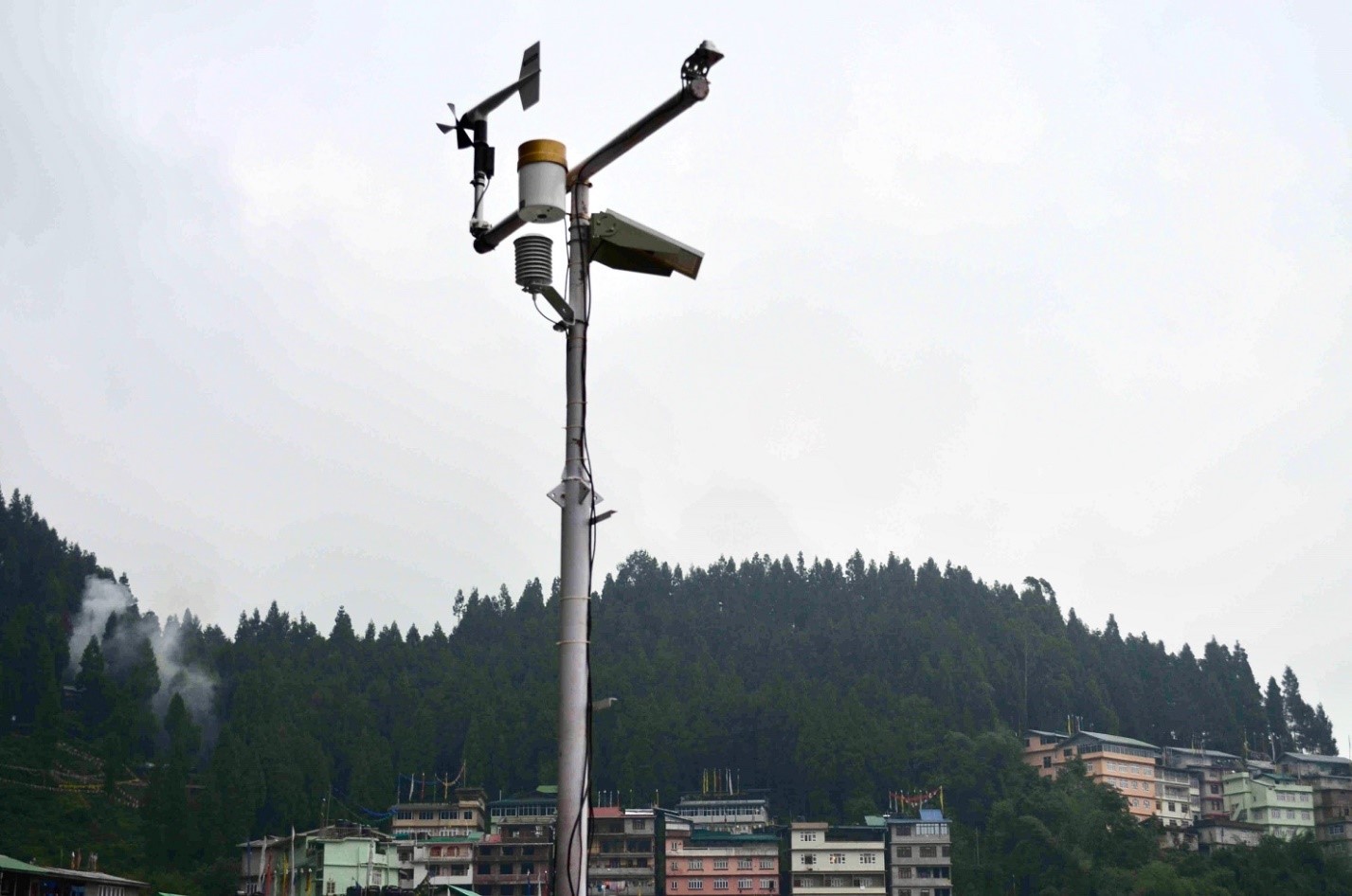
Sensors at Chandmari Village in Sikkim’s Gangtok District

Sikkim Gets Real-Time Landslide Warning System

  • Research Stash
  • News
  • 1.9K

A real-time landslide warning system has been set up in the Sikkim-Darjeeling belt of the north-eastern Himalayas which is highly vulnerable to landslides. This system can help save lives and loss to property by issuing advance alerts.

The warning system consists of over 200 sensors that can measure geophysical and hydrological parameters like rainfall, pore pressure, and seismic activities.  It has been set up on slopes spread over 150 acres at Chandmari village in Gangtok.

It will monitor a densely populated area which has seen landslides in the past.  The system is capable of warning about 24 hours in advance. People could be safely evacuated in this period.
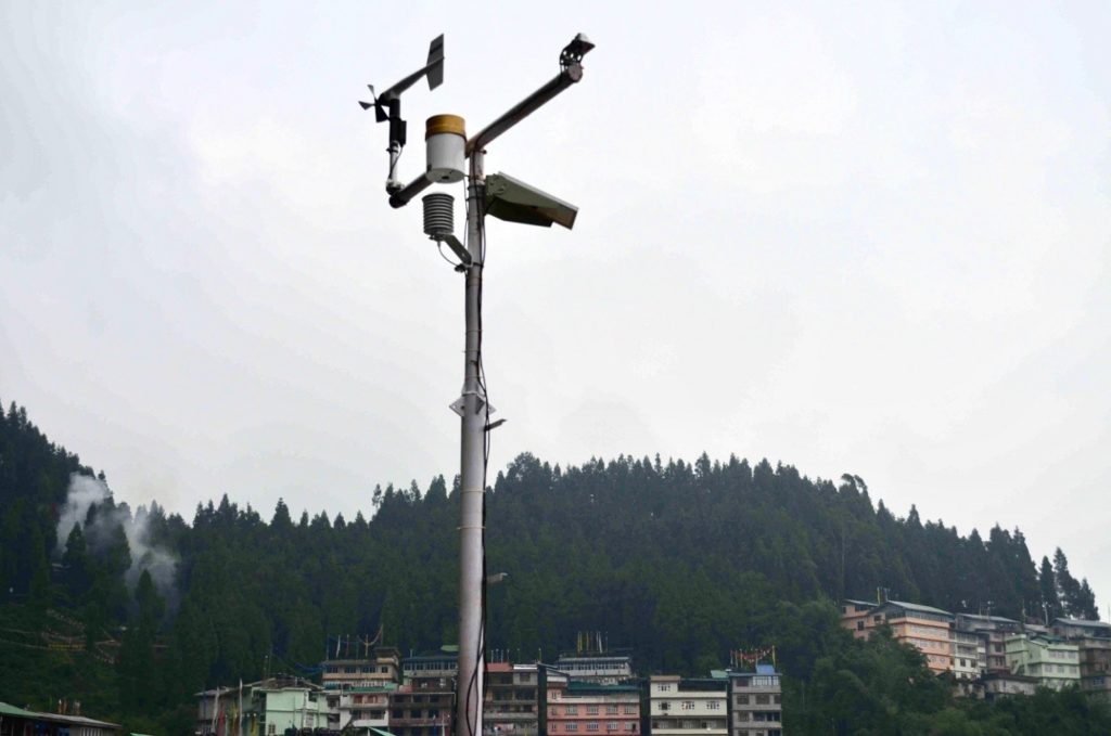
Sensors at Chandmari Village in Sikkim’s Gangtok District

Image: Sensors at Chandmari Village in Sikkim’s Gangtok District

This landslide warning system has been deployed by the researchers of Kerala based Amrita University in collaboration with the Sikkim State Disaster Management Authority. The project has been partly funded by the Ministry of Earth Sciences.

The system collects real-time, continuous data from the sensors and performs basic analysis at the locally established control center and relays the same to the Data Management Center at Amrita Vishwa Vidyapeetham in Kerala’s Kollam district.

The researchers use this data to characterize geological and hydrological factors and response of the hill with respect to dynamic and real-time meteorological variations to develop a warning.

Dr. Manisha Sudheer, the lead researcher associated with this project, said “this is an in-situ system which has been deployed with the help of various sensors. These sensors are installed within land surface by drilling a pipe. The system is solar powered.”
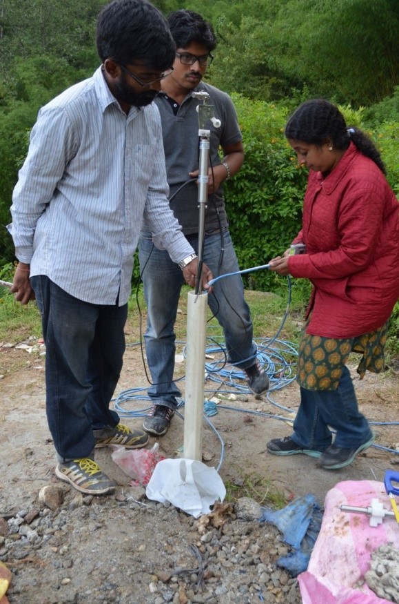
Installing the sensors at Chandmari Village in Sikkim’s Gangtok

Image: Installing the sensors at Chandmari Village in Sikkim’s Gangtok

Sikkim’s 4,895 square kilometer area is sensitive to landslides, of which 3,638 sq km area is surrounded by human population, roads and other infrastructure.

“This multi-level warning system will help disaster management authorities to take steps to mitigate and manage potential landslide threats in a proactive and effective manner. We have performed several community engagement programs to disseminate knowledge regarding the impact of landslides, the working of the warning system and its capability to warn about imminent landslides”, said researchers.

Landslides are triggered by natural causes like vibrations from earthquakes and the build-up of water pressure between soil layers due to prolonged rainfall or seepage.

In recent decades, man-made causes have become significant in triggering landslides, including removal of vegetation from the slopes, interference with natural drainage, leaking water or sewer pipes, modification of slopes by the construction of roads, railways, buildings etc.

Landslides can be detected at different accuracy levels using models, sensors or satellite images. Rainfall threshold based models are most commonly used but may lead to false-positives predictions.

“More accurate landslide databases need to be maintained and regional as well as site-specific rainfall threshold models developed. Low-cost in-situ monitoring technologies have to be deployed in landslide-prone terrains.

People have to be educated regarding landslides and the risks involved. Social media and mobile phone apps can be developed to collect data about the chances or precursors for landslides from the people and other governmental organizations,” said Dr. Sudheer.

Umashankar Mishra

If you liked this article, then please subscribe to our YouTube Channel for the latest Science & Tech news. You can also find us on Twitter & Facebook.

Rate

Sensors at Chandmari Village in Sikkim’s Gangtok District

Image: Sensors at Chandmari Village in Sikkim’s Gangtok District

This landslide warning system has been deployed by the researchers of Kerala based Amrita University in collaboration with the Sikkim State Disaster Management Authority. The project has been partly funded by the Ministry of Earth Sciences.

The system collects real-time, continuous data from the sensors and performs basic analysis at the locally established control center and relays the same to the Data Management Center at Amrita Vishwa Vidyapeetham in Kerala’s Kollam district.

The researchers use this data to characterize geological and hydrological factors and response of the hill with respect to dynamic and real-time meteorological variations to develop a warning.

Dr. Manisha Sudheer, the lead researcher associated with this project, said “this is an in-situ system which has been deployed with the help of various sensors. These sensors are installed within land surface by drilling a pipe. The system is solar powered.”

Installing the sensors at Chandmari Village in Sikkim’s Gangtok

Image: Installing the sensors at Chandmari Village in Sikkim’s Gangtok

Sikkim’s 4,895 square kilometer area is sensitive to landslides, of which 3,638 sq km area is surrounded by human population, roads and other infrastructure.

“This multi-level warning system will help disaster management authorities to take steps to mitigate and manage potential landslide threats in a proactive and effective manner. We have performed several community engagement programs to disseminate knowledge regarding the impact of landslides, the working of the warning system and its capability to warn about imminent landslides”, said researchers.

Landslides are triggered by natural causes like vibrations from earthquakes and the build-up of water pressure between soil layers due to prolonged rainfall or seepage.

In recent decades, man-made causes have become significant in triggering landslides, including removal of vegetation from the slopes, interference with natural drainage, leaking water or sewer pipes, modification of slopes by the construction of roads, railways, buildings etc.

Landslides can be detected at different accuracy levels using models, sensors or satellite images. Rainfall threshold based models are most commonly used but may lead to false-positives predictions.

“More accurate landslide databases need to be maintained and regional as well as site-specific rainfall threshold models developed. Low-cost in-situ monitoring technologies have to be deployed in landslide-prone terrains.

People have to be educated regarding landslides and the risks involved. Social media and mobile phone apps can be developed to collect data about the chances or precursors for landslides from the people and other governmental organizations,” said Dr. Sudheer.

Umashankar Mishra

If you liked this article, then please subscribe to our YouTube Channel for the latest Science & Tech news. You can also find us on Twitter & Facebook.
" }
New Analysis Says Puga Has Highest Geothermal Potential

New Analysis Says Puga Has Highest Geothermal Potential

A team of researchers from Birla Institute of Technology and Science, Pilani have used nine parameters to analyse data relating to Puga in Ladakh, Chhumathang in Jammu and Kashmir, Manikaran in Himachal Pradesh, Tattapani in Chhattisgarh, Unhavre Khed in Maharashtra and Tapoban in Uttarakhand. Based on this analysis, they have concluded that Puga has the most potential.

  • News
  • 3.2K
Read more
How Microscopic Marine Algae Impact Global Climate and Indian Monsoon

How Microscopic Marine Algae Impact Global Climate and Indian Monsoon

In a few weeks from now, a seasonal forecast for the Indian summer monsoon will be announced. Among various parameters that determine the fate of the monsoon is the sea surface temperature, more specifically, the contrast between land and sea temperatures.

  • News
  • 2.6K
Read more
P C Mahalanobis and Niels Bohr on a conversation at ISI on January 16, 1960. (Photo ISI)

This Is How P C Mahalanobis Dabbled with Computing in Early 20th Century

We are all familiar with number crunching, data mining and the use of supercomputers today. How did people handle large calculations before the advent of modern computers?

  • News
  • 2.4K
Read more

Internet is huge! Help us find great content

Newsletter

Never miss a thing! Sign up for our newsletter to stay updated.

About

Research Stash is a curated collection of tools and News for S.T.E.M researchers

Have any questions or want to partner with us? Reach us at hello@researchstash.com

Navigation

Submit